Aspen Regeneration Monitoring
in Colorado, South Dakota, and Utah
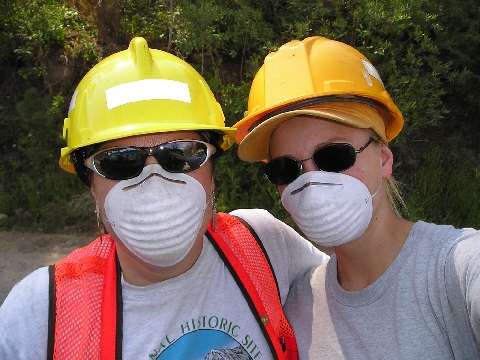
We always wore appropriate protection.
Shauna Rae Brown, crew leader, and Jill Dalton, crew member.

We always wore appropriate protection.
Shauna Rae Brown, crew leader, and Jill Dalton, crew member.
This work was the result of a project funded by the Rocky Mountain Research Station and Region 2 of the U.S.D.A. Forest Service. The Project Leader was Dale Bartos of the RMRS Logan's Restoration Ecology work unit. The Field Work Coordinator and Crew Leader was Shauna Rae Brown, an Ecologist with the Fishlake National Forest, Utah. Aspen monitoring in the Sanford Fire burn area was funded by the Dixie National Forest, as a part of their Monitoring Plan.
Six wildfire burn areas were sampled over five national forests in three states. The three burn areas in Colorado are the Rio Grande National Forest's Million Fire 2002, the San Juan National Forest's Missionary Ridge Fire 2002, and the Pike National Forest's Hayman Fire 2002. Two burn areas were sampled on the Black Hills National Forest in South Dakota: Battle Creek Fire 2002, and Jasper Fire 2000. The last burn area was the Dixie National Forest's Sanford Fire 2002 on the Powell Ranger District. In all, 76 sites were sampled and designated according to an estimated burn severity.
For each site sampled on the Million and Missionary Ridge burn areas, photosets of 4 photographs at plot 10 were taken. The sequence of photographs is north, east, south, and west. The photosets for the Hayman Fire contain 5 images, with the first or last being a title or site identification shot. Since burn intensities were difficult to estimate, each site sampled on the Black Hills and Dixie National Forests (Battle Creek and Jasper Fires [South Dakota], and Sanford Fire [Utah]), there are 3 photosets of 5 photographs each taken at plots 1, 10, and 20. The sequence of photographs is usually the title, north, east, south, and west, but there are a few exceptions in which the title shot follows the cardinal shots.
All photographs were taken with an Olympus Camedia D-560 Zoom, a digital camera, and are in jpeg (Joint Photographic Experts Group) or *.jpg format. File sizes range between 550KB to 780KB at 2048 x 1536 pixels in 24 bit True RGB color. Global Positioning System (GPS) locations were also collected at plots 1, 10, and 20 with a Garmin eTrex Vista, which were written as Latitude/Longitude in the field, and then were later downloaded and converted into shapefiles for use in ESRI's ArcView 3.x or ArcGIS 8.3. The use of these products is neither an endorsement, nor a condemnation for their use.
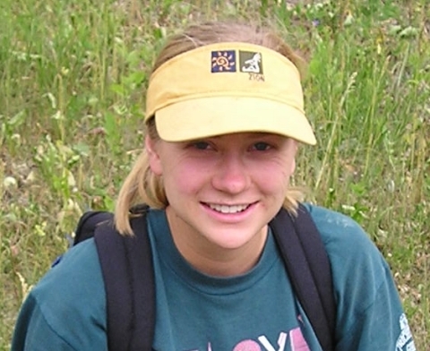
Jill Dalton: crew member and Richfield vehicle coordinator.
While in the Durango, Colorado area, we sampled the Million and Missionary Ridge Fires of 2002. Twelve sites, three each of no, low, moderate, and high burn, were sampled on the Rio Grande National Forest's Million Fire. We only had time to sample four sites, two of each burn type, on the San Juan National Forest's Missionary Ridge Fire. The Million Fire and Missionary Ridge Fire burn areas are abbreviated RG and SJ, respectively.
| Summary of Rio Grande & San Juan N. F. Sites Sampled | |||||||
|---|---|---|---|---|---|---|---|
| Site ID | Burn | Location | Elevation | Slope | Aspect | Date Sampled | Mean Stems/acre |
| RG-01M | Moderate | N 37º 38.144' W 106º 39.599' |
8381 ft. | 20% | 325º | 08 Jul 03 | std.dev |
| RG-02H | High | N 37º 38.798' W 106º 34.331' |
9609 ft. | 12% | 355º | 09 Jul 03 | std.dev |
| RG-03HM | High | N 37º 38.763' W 106º 34.460' |
9657 ft. | 13% | 310º | 09 Jul 03 | std.dev |
| RG-04LM | Low-Moderate | N 37º 38.896' W 106º 34.330' |
9612 ft. | 4% | 295º | 09 Jul 03 | std.dev |
| RG-05M | Moderate | N 37º 38.065' W 106º 34.130' |
10,008 ft. | 22% | 30º | 10 Jul 03 | std.dev |
| RG-06M | Moderate | N 37º 38.380' W 106º 35.614' |
9250 ft. | 26% | 226º | 10 Jul 03 | std.dev |
| RG-07L | Low | N 37º 37.129' W 106º 40.199' |
8543 ft. | 10% | 345º | 14 Jul 03 | std.dev |
| RG-08L | Low | N 37º 39.216' W 106º 36.032' |
8691 ft. | 12% | 85º | 14 Jul 03 | std.dev |
| RG-09U | Unburned | N 37º 38.387' W 106º 33.922' |
9585 ft. | 17% | 35º | 14 Jul 03 | std.dev |
| RG-10H | High | N 37º 38.473' W 106º 34.592' |
9772 ft. | 20% | 325º | 15 Jul 03 | std.dev |
| RG-11U | Unburned | N 37º 37.738' W 106º 33.747' |
10,083 ft. | 18% | 0º | 15 Jul 03 | std.dev |
| RG-12U | Unburned | N 37º 38.153' W 106º 35.646' |
9411 ft. | 8% | 235º | 15 Jul 03 | std.dev |
| SJ-01M | Moderate | N 37º 25.690' W 107º 46.534' |
7951 ft. | 40% | 325º | 17 Jul 03 | std.dev |
| SJ-02L | Low | N 37º 25.581' W 107º 46.390' |
8152 ft. | 17% | 325º | 17 Jul 03 | std.dev |
| SJ-03U | Unburned | N 37º 27.607' W 107º 39.155' |
10,150 ft. | 10% | 275º | 18 Jul 03 | std.dev |
| SJ-04M | Moderate | N 37º 26.060' W 107º 45.293' |
8424 ft. | 53% | 10º | 19 Jul 03 | std.dev |
| SJ-05L | Low | N 37º 25.825' W 107º 44.924' |
8672 ft. | 20% | 309º | 19 Jul 03 | std.dev |
| SJ-06H | High | N 37º 25.924' W 107º 44.471' |
8914 ft. | 20% | 215º | 19 Jul 03 | std.dev |
| SJ-07H | High | N 37º 26.293' W 107º 44.598' |
9047 ft. | 23% | 250º | 21 Jul 03 | std.dev |
| SJ-08U | Unburned | N 37º 28.389' W 107º 44.148' |
10,566 ft. | 40% | 47º | 21 Jul 03 | std.dev |
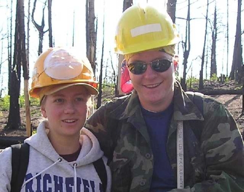
Left to Right: Jill Dalton and Tiffany Johns.
While stationed in the Woodland Park, Colorado area, we sampled the Pike National Forest's Hayman Fire of 2002. Sixteen sites, four each of no, low, moderate, and high burn, were sampled. The abbreviation for sites sampled here is "PH" for Pike-Hayman.
| Summary of Pike N. F., Hayman Fire Sites Sampled | |||||||
|---|---|---|---|---|---|---|---|
| Site ID | Burn | Location | Elevation | Slope | Aspect | Date Sampled | Mean Stems/acre |
| PH-01M | Moderate | N 39º 11.190' W 105º 21.503' |
7898 ft. | 9% | 337º | 29 Jul 03 | std.dev |
| PH-02M | Moderate | N 39º 11.232' W 105º 21.925' |
8169 ft. | 23% | 63º | 29 Jul 03 | std.dev |
| PH-03L | Low | N 39º 11.814' W 105º 21.930' |
8402 ft. | 21% | 110º | 29 Jul 03 | std.dev |
| PH-04H | High | N 39º 06.081' W 105º 214.942' |
8761 ft. | 27% | 55º | 30 Jul 03 | std.dev |
| PH-05H | High | N 39º 07.654' W 105º 22.102' |
8258 ft. | 15% | 71º | 30 Jul 03 | std.dev |
| PH-06L | Low | N 39º 08.227' W 105º 22.027' |
8521 ft. | 7% | 203º | 30 Jul 03 | std.dev |
| PH-07H | High | N 39º 01.542' W 105º 16.309' |
9194 ft. | 7% | 356º | 31 Jul 03 | std.dev |
| PH-08L | Low | N 39º 02.884' W 105º 17.158' |
9373 ft. | 29% | 59º | 31 Jul 03 | std.dev |
| PH-09U | Unburned | N 39º 03.103' W 105º 17.023' |
9203 ft. | 5% | 350º | 31 Jul 03 | std.dev |
| PH-10U | Unburned | N 39º 03.382' W 105º 16.986' |
9137 ft. | 18% | 122º | 31 Jul 03 | std.dev |
| PH-11U | Unburned | N 39º 01.743' W 105º 15.638' |
9007 ft. | 4% | 2º | 01 Aug 03 | std.dev |
| PH-12M | Moderate | N 39º 03.046' W 105º 14.961' |
8757 ft. | 30% | 65º | 01 Aug 03 | std.dev |
| PH-13M | Moderate | N 39º 03.436' W 105º 146.689' |
8782 ft. | 36% | 153º | 01 Aug 03 | std.dev |
| PH-14L | Low | N 39º 03.690' W 105º 15.613' |
8808 ft. | 32% | 25º | 02 Aug 03 | std.dev |
| PH-15H | High | N 39º 06.319' W 105º 16.768' |
8611 ft. | 18% | 45º | 02 Aug 03 | std.dev |
| PH-16U | Unburned | N 39º 04.202' W 105º 17.079' |
9166 ft. | 21% | 113º | 04 Aug 03 | std.dev |
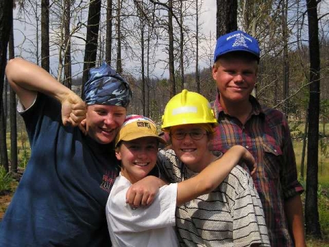
Left to Right: Tiffany Johns, Jill Dalton, Helena Torgerson, and John Peterson.
We sampled 21 sites on the Black Hills National Forest; 9 on the Battle Creek Burn Area, and 12 on the Jasper Burn Area. Jasper Fire burn area and Battle Creek Fire burn area are abbreviated JA and BC, respectively, with the sites indicated by the hyphenated two-digit number. The latitude/longitudes given are from plot 10. Burn severities/intensities noted were estimated based on the amount of black found in the under- and overstory.
| Summary of Black Hills N. F. Sites Sampled | |||||||
|---|---|---|---|---|---|---|---|
| Site ID | Burn | Location | Elevation | Slope | Aspect | Date Sampled | Mean Stems/acre |
| JA-01 | Low | N 43º 44.793' W 103º 50.245' |
5451 ft. | 1% | 291º | 15 Aug 03 | std.dev |
| JA-02 | Unburned | N 43º 45.020' W 103º 45.852' |
5822 ft. | 5% | valley bottom | 15 Aug 03 | std.dev |
| JA-03 | High | N 43º 48.078' W 103º 47.326' |
6304 ft. | 14% | 31º | 15 Aug 03 | std.dev |
| JA-04 | Moderate | N 43º 47.922' W 103º 47.823' |
6194 ft. | 37% | 335º | 16 Aug 03 | std.dev |
| JA-05 | Low | N 43º 46.771' W 103º 48.064' |
6010 ft. | 25% | 40º | 16 Aug 03 | std.dev |
| JA-06 | Unburned | N 43º 50.606' W 103º 50.117' |
6486 ft. | 10% | 277º | 16 Aug 03 | std.dev |
| JA-07 | Moderate | N 43º 52.202' W 103º 52.039' |
6496 ft. | 3% | 355º | 16 Aug 03 | std.dev |
| JA-08 | Moderate | N 43º 50.915' W 103º 47.245' |
6504 ft. | 5% | 25º | 17 Aug 03 | std.dev |
| JA-09 | High | N 43º 54.614' W 103º 52.245' |
6677 ft. | 3% | 315º | 20 Aug 03 | std.dev |
| JA-10 | Moderate | N 43º 54.323' W 103º 51.738' |
6646 ft. | 10% | 235º | 20 Aug 03 | std.dev |
| JA-11 | Low | N 43º 54.261' W 103º 51.732' |
6651 ft. | 14% | 9º | 20 Aug 03 | std.dev |
| JA-12 | Unburned | N 43º 53.837' W 103º 51.572' |
6546 ft. | 5% | 200º | 20 Aug 03 | std.dev |
| BC-01 | Low | N 43º 56.941' W 103º 24.283' |
5039 ft. | 24% | 8º | 18 Aug 03 | std.dev |
| BC-02 | Unburned | N 43º 56.127' W 103º 24.023' |
4652 ft. | 56% | 253º | 18 Aug 03 | std.dev |
| BC-03 | Moderate | N 43º 54.399' W 103º 21.898' |
4377 ft. | 17% | 30º | 19 Aug 03 | std.dev |
| BC-04 | Moderate | N 43º 54.388' W 103º 20.885' |
4372 ft. | 11% | 61º | 19 Aug 03 | std.dev |
| BC-05 | Low | N 43º 53.560' W 103º 20.558' |
4216 ft. | 10% | 83º | 19 Aug 03 | std.dev |
| BC-06 | Low | N 43º 53.391' W 103º 20.200' |
4149 ft. | 12% | 156º | 19 Aug 03 | std.dev |
| BC-07 | Low | N 43º 55.924' W 103º 21.806' |
4515 ft. | 27% | 354º | 19 Aug 03 | std.dev |
| BC-08 | Unburned | N 43º 55.670' W 103º 24.051' |
4611 ft. | 7% | 22º | 21 Aug 03 | std.dev |
| BC-09 | Unburned | N 43º 56.131' W 103º 23.784' |
4651 ft. | 27% | 287º | 21 Aug 03 | std.dev |
The people pictured below helped me sample aspen (Populus tremuloides) regeneration on
the Dixie National Forest, Utah during 21-30 October 2003.
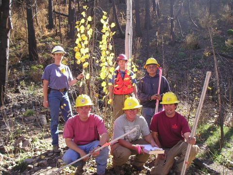
Shown left to right
(back row): Linda Chappell, Scott Tobler, and Lymer Nez.
(front row): John Harding, Randy Dickinson, and David Veater.
We sampled 19 sites on the Dixie National Forest's Powell Ranger District, located near Panguitch, Utah. Sampling sites were named for the area (first two letters or if three letters refers to sites sampled in 2002), two-digit number (referring to chronological order), and burn severity observed (last letter in the abbreviation). The Lat/Longs given are from plot 10. Burn severities were estimated based on the amount of black found in the under- and overstory. The Executive Summary gives a brief summary of the report written following this monitoring.
| Summary of Sanford Fire Sites Sampled | |||||||
|---|---|---|---|---|---|---|---|
| Site ID | Burn Severity | Location | Elevation | Slope | Aspect | Date Sampled | Mean Stems/acre |
| CW-04 | Low | N 37º 56.632' W 112º 07.772' |
8,207 ft. | 3% | 125º | 21 Oct 03 | 26,050 std.dev 16,217 |
| CW-05 | High | N 37º 56.327' W 112º 08.691' |
8,374 ft. | 8% | valley bottom | 21 Oct 03 | 32,050 std.dev 38,444 |
| CWS-05 | Moderate | N 37º 56.170' W 112º 11.086' |
8,818 ft. | 8% | 30º | 22 Oct 03 | 22,100 std.dev 23,622 |
| CWS-06 | Low | N 37º 56.283' W 112º 118.134' |
8,856 ft. | 21% | 195º | 22 Oct 03 | 21,600 std.dev 18,234 |
| CW-06 | Unburned | N 37º 56.944' W 112º 12.343' |
9,439 ft. | 21% | 215º | 22 Oct 03 | 1,550 std.dev 1,905 |
| CWS-07 | High | N 37º 57.174' W 112º 12.704' |
9,639 ft. | 10% | 50º | 27 Oct 03 | 31,850 std.dev 18,994 |
| CWS-08 | High | N 37º 57.204' W 112º 12.749' |
9,706 ft. | 30% | 140º | 22 Oct 03 | 10,800 std.dev 11,063 |
| CWS-09 | Low | N 37º 57.716' W 112º 13.104' |
9,844 ft. | 12% | 210º | 27 Oct 03 | 23,400 std.dev 30,809 |
| CWS-10 | Moderate | N 37º 57.789' W 112º 12.902' |
9,966 ft. | 15% | 90º | 27 Oct 03 | 30,857 std.dev 32,962 |
| CWS-11 | Unburned | N 37º 58.461' W 112º 12.949' |
10,064 ft. | 45% | 270º | 27 Oct 03 | 1,714 std.dev 2,028 |
| CWS-12 | High | N 37º 59.234' W 112º 13.519' |
9,865 ft. | 33% | 221º | 27 Oct 03 | 6,550 std.dev 8,482 |
| EH-01 | Unburned | N 37º 51.279' W 112º 10.055' |
8,100 ft. | 57% | 60º | 29 Oct 03 | 1,700 std.dev 2,342 |
| CO-01 | Low | N 37º 51.994' W 112º 11.613' |
8,435 ft. | 38% | 145º | 29 Oct 03 | 19,905 std.dev 17,184 |
| CO-02 | Unburned | N 37º 51.601' W 112º 12.304' |
8,549 ft. | 12% | 335º | 29 Oct 03 | 450 std.dev 999 |
| WHZ-01 | Low | N 37º 48.179' W 112º 11.470' |
8,271 ft. | 1% | 334º | 28 Oct 03 | 30,600 std.dev 28,050 |
| WHZ-02 | Moderate | N 37º 48.705' W 112º 11.778' |
8,129 ft. | 3% | 83º | 28 Oct 03 | 17,650 std.dev 25,155 |
| WHZ-03 | Low | N 37º 50.031' W 112º 11.905' |
8,165 ft. | 1% | 155º | 28 Oct 03 | 21,450 std.dev 16,513 |
| WHZ-04 | Low | N 37º 51.128' W 112º 12.778' |
8,458 ft. | 18% | 117º | 28 Oct 03 | 63,450 std.dev 29,953 |
| NFDC-01 | High | N 38º 00.814' W 112º 09.989' |
9,318 ft. | flat | 55º | 30 Oct 03 | 22,000 std.dev 22,641 |

Home | Master's Thesis | Abstracts & Executive Summaries | Courses Taken
This page last updated 2 January 2012.
All photographs & artwork by Shauna Rae Brown